File:OJ GPS 11.png
Jump to navigation
Jump to search
Size of this preview: 800 × 599 pixels. Other resolutions: 320 × 240 pixels | 892 × 668 pixels.
Original file (892 × 668 pixels, file size: 199 KB, MIME type: image/png)
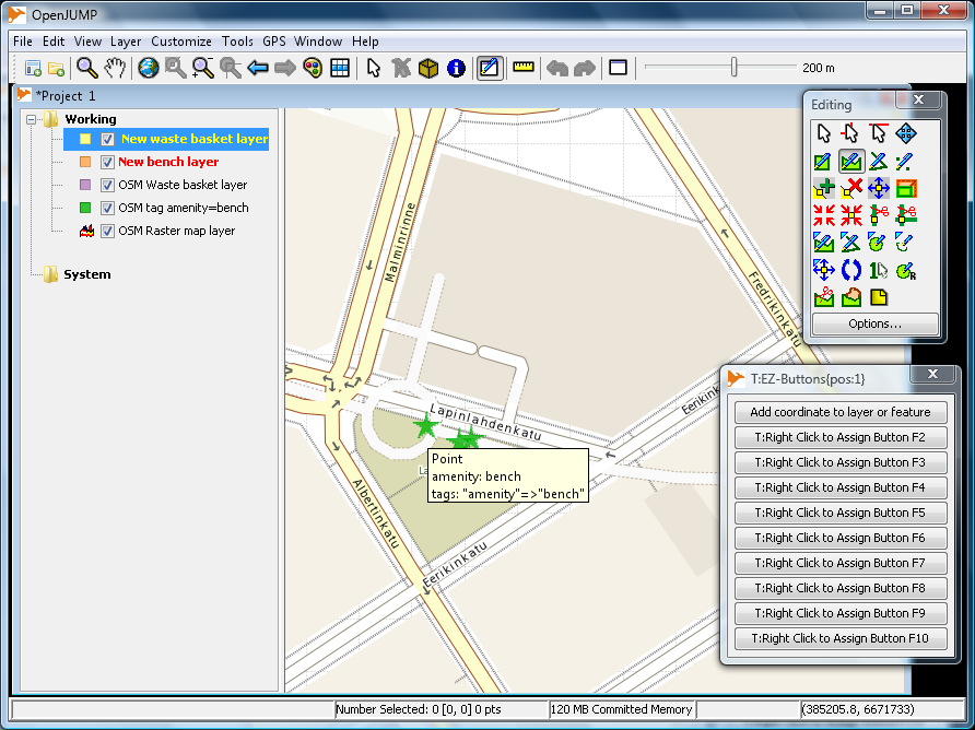
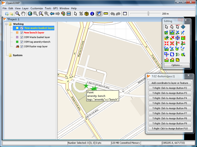
OpenJUMP task ready for a field test. Layers: raster image from WMS server, two vector layers from PostGIS database, two editable layers for collecting GPS measurement data.
File history
Click on a date/time to view the file as it appeared at that time.
| Date/Time | Thumbnail | Dimensions | User | Comment | |
|---|---|---|---|---|---|
| current | 13:11, 11 August 2010 | | 892 × 668 (199 KB) | Jratike80 (talk | contribs) | OpenJUMP task ready for a field test. Layers: raster image from WMS server, two vector layers from PostGIS database, two editable layers for collecting GPS measurement data. |
You cannot overwrite this file.
File usage
The following page uses this file: